

-
- About the District
- Administration
-
Local Government
district Council
-
তথ্য প্রদানকারী কর্মকর্তার তথ্য
-
নোটিশ বোর্ড
-
e-Tender Notice
-
প্রধান নির্বাহী কর্মকর্তার প্রোফাইল
-
ঠিকাদারী লাইসেন্স নবায়ন বিজ্ঞপ্তি ২০২০-২০২১
-
District Council Office
-
Officers/employers of the District council
-
Compulsory functions of the district council
-
Dakbangalow
-
Progress Report
-
Communucation
-
citizen charter
-
Budget Summary 2019-2020
-
Chairman of the former District Council
-
Administrator\'s message
-
organizational structure
-
তথ্য প্রদানকারী কর্মকর্তার তথ্য
-
Govt. Offices
Agriculture & Food
-
District Food Office
-
Department Of Agriculture Extension.
-
District Livestock Office.
-
District marketing Office.
-
District Fishery Office
-
BADC (Seed)
-
District Seed Certification Agency Office
-
District Cotton Development Board Office
-
Bangladesh Food Safety Authority, District Office, Meherpur
-
badc (mi)
Engineering and ICT
-
LGED
-
Education Engineering Department
-
Department of Public Health Engineering
-
BTCL
-
Meherpur Electric Supply, WZPDCL, Meherpur
-
Meherpur Palli Bidyut Samity
-
Industrial Assistant Center
-
Meherpur Head Post Office
-
Public Works Department.
-
Road and Highways Department.
-
District Relief and Rehabilitation Office
-
DoICT, Meherpur
-
Bangladesh Water Development Board, Meherpur
About Human Resources Development
-
Islamic Foundation
-
Bangladesh Rural Development Board.
-
District Co-operative Office
-
District Women Affairs Office
-
District Social Welfare Office.
-
District Youth Development Office
-
Urban Social Services Office, Meherpur
-
Disability Service and Support Center, Meherpur
-
Meherpur Technical Training Center
-
District Hindu Religious Welfare Trust Officw
-
Integrated Visually Impaired Education Program, Meherpur
-
District Food Office
- Others Institute
- Photo Gallery
- e-Services
-
-
-
About the District
District Contact
History and Tradition
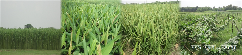
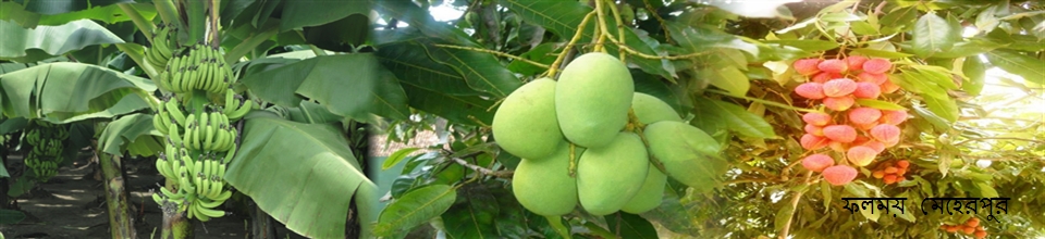
Geographical and Economic
-
Administration
Deputy Commissioner.
Deputy Commissioner\'s Office
DDLG/Additional District Commissioners
Officers and Employees
Branch related
Important Information
-
Local Government
Meherpur Pourashava
Formation of Municipality
Activities of the Municipality
district Council
- তথ্য প্রদানকারী কর্মকর্তার তথ্য
- নোটিশ বোর্ড
- e-Tender Notice
- প্রধান নির্বাহী কর্মকর্তার প্রোফাইল
- ঠিকাদারী লাইসেন্স নবায়ন বিজ্ঞপ্তি ২০২০-২০২১
- District Council Office
- Officers/employers of the District council
- Compulsory functions of the district council
- Dakbangalow
- Progress Report
- Communucation
- citizen charter
- Budget Summary 2019-2020
- Chairman of the former District Council
- Administrator\'s message
- organizational structure
LGSP-2
-
Govt. Offices
Law-discipline and security issues
Education & culture
Agriculture & Food
- District Food Office
- Department Of Agriculture Extension.
- District Livestock Office.
- District marketing Office.
- District Fishery Office
- BADC (Seed)
- District Seed Certification Agency Office
- District Cotton Development Board Office
- Bangladesh Food Safety Authority, District Office, Meherpur
- badc (mi)
Engineering and ICT
- LGED
- Education Engineering Department
- Department of Public Health Engineering
- BTCL
- Meherpur Electric Supply, WZPDCL, Meherpur
- Meherpur Palli Bidyut Samity
- Industrial Assistant Center
- Meherpur Head Post Office
- Public Works Department.
- Road and Highways Department.
- District Relief and Rehabilitation Office
- DoICT, Meherpur
- Bangladesh Water Development Board, Meherpur
About Human Resources Development
- Islamic Foundation
- Bangladesh Rural Development Board.
- District Co-operative Office
- District Women Affairs Office
- District Social Welfare Office.
- District Youth Development Office
- Urban Social Services Office, Meherpur
- Disability Service and Support Center, Meherpur
- Meherpur Technical Training Center
- District Hindu Religious Welfare Trust Officw
- Integrated Visually Impaired Education Program, Meherpur
About the Health
Land & Revenue
-
Others Institute
Education
Organization
Non Govt. Institute
ধর্মীয় প্রতিষ্ঠান
-
Photo Gallery
Photo Gallery
Video Gallery
-
e-Services
National E-Service
Union Information & Service Center.
-
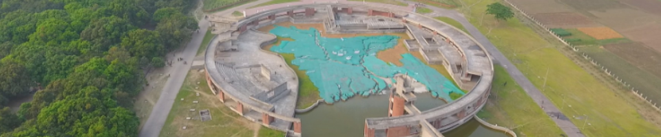
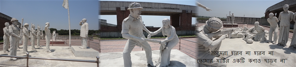
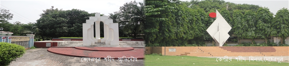
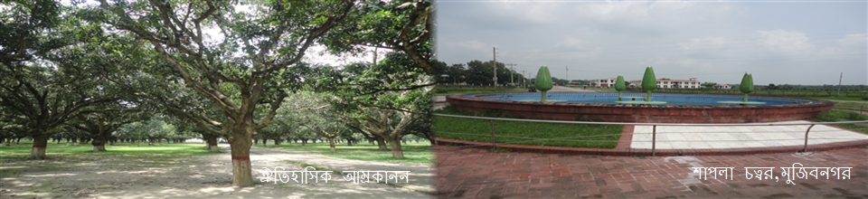
We have already got two preeminent information about the name of Meherpur. One is the name of Meherpur, after some time, in the conjunction with the name of a person named Islam, according to the name of a person named Meher Ali. The name of Meherpur was started after some time. The spread of Islam was started from the beginning of Muslim rule in this region. Hazrat Khan Jahan Ali (R), started spreading Islam widely in the areas of greater Kushtia, Jessore, Khulna, Barobazar, Chuadanga and Meherpur. Pir Khan Jahan Ali went to Bagerhat on Barobazar via Meherpur on the way to Bhairab from Gaur. At that time it is said that there were 360 saints and 60 thousand soldiers. He hoisted the flag of Islam in the southern part of the country and established settlement and governance system. At the same time in this region, the arrival of Allah's blessed blessed personality came to be a number of Islamists. Shah Alai, Shah Alai and Enayet Ullah are notable. The name of Meherpur was established in line with the name of Durga Mehr Ali Shah, the goddess of Purna Atna Islam. It is known that Meher Ali was very well known as a very influential and famous spiritual person. The second aspect of the origin of Namharpur name is to be noted here, in the travelogue of the East Bengal Railway, Mihir and his own son-in-law Khanna (famous for Khana Bachchan) lived in this region on the banks of the Bhairab river. It is assumed that named after Meherpur in Mihirpur and later in the subconscious, named after him. Declaration of Independence, Bangladesh's official declaration of independence of Bangladesh on April 17, 1971. During the Liberation War, the expatriate Mujibnagar Government came into effect as the interim Constitution of the country. Even before the formation of the new constitution of independent Bangladesh on 16 December, 1972, this declaration was effective as the country's constitution. On 25 March 1971, the Pakistani Awami League leaders, Constituencies and provincial council members took refuge in India on the pretext of attacking the people in Dhaka and other parts of East Pakistan during the Pakistani military on March 25, after crossing the border for safety. Many of them gathered in Calcutta by March 30th. The members of the Constituent Assembly and the Provincial Assembly met in Calcutta by April 10, forming a Expatriate Legislative Council and formulating the Declaration of Independence. On 17 April, member of the Constituent Assembly, M Yusuf Ali, officially announced the Declaration of Independence on an informal ceremony at Vaidyanathtala (present day Mujibnagar) on the border of Meherpur district. With the announcement, the newly formed Legislative Assembly declared independence and sovereignty of Bangladesh. In this announcement the expatriate Mujibnagar government was considered to be valid and in this announcement, it was instructed to set up chain of command among all those who participated in the liberation war.
The date of the announcement of the district was completed on 24 February 1984 in the district of Meherpur. On 24 February 2000, Meherpur Sadar Upazila was divided into Mujibnagar upazila. There are three upazilas in present-day district of present-day
The district is situated between 23.44 / 23.59 / latitude and 88.34 / 88.53 east longitude. It is the border district of western part of Bangladesh. Daulatpur Thana of Kushtia district is West Bengal (India); southwest of Chuadanga district; Damurhuda Thana is in West Bengal (India); Mirpur in Kushtia district, Alamdanga in Chuadanga district; West Bengal of India; West Bengal, on the west, has about 60 km Indian border crossing north-south across the western part of Meherpur. Size and structure are 716.08 sq km. It consists of 03 upazilas, 03 thanas, 2 municipalities (1 class, 1 st class), 18 union, 199 mouzas and 255 villages. Name of Upazilas - Meherpur Sadar, Mujibnagar and Gangni Upazila.
Population population 6,55,392 (according to 2011 census), the number of men and women is 3,24,634 and 3,30,758, the number of total number of 1,66,300. Muslim 97.76%, Hindu 1.20%, Christian 1.01%, Buddhists 0.001% Others 0.019%. Annual population growth rate is 1.02% (according to 2011 census). The population density of this district is 821 kilometers per square kilometer. The settlements have been built on the basis of the ancient towns of Bangladesh, in the relatively high places both on the banks of the river Bhairab, Kajla, Chewati, Mathabhanga etc. and on the modern day road. Apart from this, settlement or cluster settlement can also be seen in the bill or haor areas. In the case of the city and business centers 84% and in the rural areas 42% pucca and semipa Housing is noticed.


Planning and Implementation: Cabinet Division, A2I, BCC, DoICT and BASIS
Technical Assistance:
![]()
Developed By:
